ガルギリヤ山
-
ハイキング
-
歴史と文化
-
自然
-
宗教的な場所
説明
Mountain / Forest Reserve
Historical Landmark
Nature & Hiking
Overview: Galgiriya Mountain (ගල්ගිරියා කන්ද)
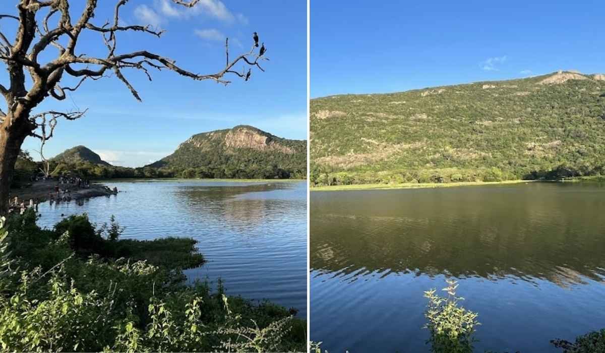
ガルギリヤ山 is an isolated mountain in the クルネーガラ地区, rising to 478 metres (1,568 ft). It is the 7th highest peak in the North Western Province and ranks as the 212th highest mountain in Sri Lanka.
Stretching over 7 km in length, Galgiriya is unique compared to other isolated hills in the region. Today, it is preserved as a forest reserve, sheltering diverse flora and fauna, making it a significant natural and ecological landmark in Sri Lanka.
歴史
The history of Galgiriya dates back to the era of King Dutugemunu. His son, Prince Saliya, famously gave up the throne for his love, Asokamala. The couple fled Anuradhapura and later settled near Galgiriya.
Prince Saliya is believed to have initiated irrigation works in the area. The mountain’s water resources were converted into tanks that supported paddy cultivation. Today, six tanks remain in the vicinity: Kuda Galawewa, Maha Galawewa, Embogama Wewa, Gaketiyagama Wewa, and Kaduruwewa.
At one end of the mountain lies the Saliya Hermitage, preserving the memory of the prince’s retreat and his connection to the land.
Features & Natural Highlights
- Length: An unusually long mountain ridge (~7 km).
- Forest Reserve: Home to valuable biodiversity including rare flora and fauna.
- 水源: Feeds nearby tanks and streams vital for agriculture.
- Hiking Potential: Trails through forested paths with panoramic views.
- Cultural Sites: Historic hermitage linked to Prince Saliya.
クイックファクト
478 m (1,568 ft)
North Western
クルネーガラ
~7 km ridge
7th highest in North Western Province
Saliya Hermitage
Kuda Galawewa, Maha Galawewa, Embogama Wewa
Forest Reserve
アクセス方法
Galgiriya Mountain is located in the クルネーガラ地区. From Kurunegala town, the mountain can be reached via local roads connecting through Embogama and surrounding villages. Private vehicles or tuk-tuks are recommended as public transport is limited to nearby towns.
訪問に最適な時期
The ideal time to visit Galgiriya Mountain is during the dry season (January – April, July – September). Mornings and late afternoons provide cooler temperatures for hiking and photography. Avoid heavy rains (October – December) as trails may become slippery.
近くの観光スポット
- Kurunegala Rock (Athugala) – iconic rock with a Buddha statue overlooking the city.
- Ridi Viharaya – ancient cave temple with Kandyan paintings (~25 km).
- Kukulegama & Embogama Tanks – irrigation lakes tied to local history.
- クルネガラ市 – historic town with colonial and cultural landmarks.
よくある質問
Is Galgiriya good for hiking?
What is the historical significance?
Are there tanks around the mountain?
訪問するには許可が必要ですか?
訪問に最適な時期
-
一年中
ハイライト
-
自転車駐車場
-
入場無料
-
駐車場あり
-
探索所要時間: 1時間
-
探索所要時間: 半日
-
トイレあり